Trails near Wörgl
96 hikes starting within 15 km, nearest first.
Nearest first, page 1 of 2

Easy · Pilgrim path
Jakobsweg Böhmen-Bayern-Tirol Variante/Breitenbach
2.0 km · ↑ 18 m · 32 min · 3 km away

Easy · Pilgrim path
Jakobsweg Böhmen-Bayern-Tirol Variante/Baumgarten
1.7 km · ↑ 14 m · 28 min · 3 km away

Medium · Summit
Juffinger Jöchl Rundtour
10.9 km · ↑ 591 m · 4 h 1 min · 4 km away

Medium · Trail
Wanderweg 21
8.5 km · ↑ 625 m · 3 h 22 min · 4 km away

Easy · Trail
Franziskusweg
3.5 km · ↑ 71 m · 58 min · 4 km away

Easy · Trail
Inntalblick Runde
5.8 km · ↑ 162 m · 1 h 49 min · 5 km away

Medium · Trail
Buchackeraufstieg
11.8 km · ↑ 319 m · 3 h 28 min · 5 km away

Demanding · Trail
Hundalm Eishöhle
13.5 km · ↑ 939 m · 5 h 13 min · 5 km away

Easy · Trail
Wanderweg von Norderberalm
3.5 km · ↑ 292 m · 1 h 27 min · 5 km away

Easy · Trail
Themenweg "Erlebnis der Sinne"
5.9 km · ↑ 149 m · 1 h 42 min · 5 km away

Medium · Trail
Wanderweg 19.
5.2 km · ↑ 562 m · 2 h 27 min · 5 km away

Easy · Trail
Themenweg "Bergbau & Kohle"
5.1 km · ↑ 198 m · 1 h 43 min · 5 km away

Medium · Trail
Pölvenrunde
16.6 km · ↑ 741 m · 5 h 45 min · 5 km away

Medium · Summit
Niederbreitenbach-Höhlenstein
7.1 km · ↑ 783 m · 3 h 23 min · 6 km away

Demanding · Summit
Prof. Rudolf Sinwel Steig - Pölven
4.5 km · ↑ 724 m · 2 h 38 min · 6 km away

Easy · Trail
Kollerhof Runde
4.9 km · ↑ 35 m · 1 h 14 min · 6 km away

Medium · Summit
Gasthof Alpenhof Runde "Adlerrunde"
12.9 km · ↑ 670 m · 4 h 30 min · 6 km away

Medium · Trail
Wanderweg 3 - Söll
9.0 km · ↑ 168 m · 2 h 29 min · 6 km away

Medium · Trail
Adlerweg - Etappe 4 Variante Höhlenstein/Hundalm
14.2 km · ↑ 542 m · 4 h 32 min · 6 km away

Medium · Summit
Wanderweg von Jausestation Roßkopfhütte zur Bergstation Markbachbahen.
1.9 km · ↑ 243 m · 59 min · 6 km away

Easy · Trail
Mühltal Runde
8.0 km · ↑ 153 m · 2 h 13 min · 6 km away

Easy · Trail
Mühltalrundweg
8.0 km · ↑ 153 m · 2 h 13 min · 6 km away

Easy · Trail
Wanderweg 70 - Itter
6.8 km · ↑ 195 m · 2 h 1 min · 7 km away

Easy · Trail
Wanderweg 7 - Söll
6.1 km · ↑ 72 m · 1 h 35 min · 7 km away

Demanding · Summit
Adlerweg Etappe 4
12.4 km · ↑ 1222 m · 5 h 34 min · 7 km away

Medium · Trail
VBA-Runde
15.9 km · ↑ 252 m · 4 h 18 min · 7 km away

Easy · Trail
Wanderweg 2 - Itter
3.2 km · ↑ 51 m · 51 min · 8 km away

Easy · Trail
Treichl Runde
4.3 km · ↑ 73 m · 1 h 10 min · 8 km away

Easy · Trail
Lindenweg
4.9 km · ↑ 80 m · 1 h 20 min · 8 km away

Easy · Trail
Wanderweg 1 - Söll
3.6 km · ↑ 73 m · 1 h 1 min · 8 km away

Medium · Trail
Badlwieden-Hacha-Runde
4.4 km · ↑ 181 m · 1 h 30 min · 8 km away

Medium · Trail
Gesundheitsbründlweg
8.0 km · ↑ 355 m · 2 h 40 min · 8 km away

Easy · Trail
Waldschönauer Runde
7.0 km · ↑ 107 m · 1 h 59 min · 9 km away

Easy · Trail
Schmieder Runde
4.2 km · ↑ 77 m · 1 h 14 min · 9 km away

Easy · Trail
Osterndorfer-Runde
5.0 km · ↑ 115 m · 1 h 30 min · 9 km away

Easy · Trail
Achrainerrunde
3.3 km · ↑ 98 m · 1 h 2 min · 9 km away

Easy · Trail
Wäschkogelrunde
7.3 km · ↑ 211 m · 2 h 11 min · 9 km away

Easy · Trail
51
4.3 km · ↑ 183 m · 1 h 25 min · 10 km away

Medium · Trail
Wanderweg 56 - Wilder Kaiser
11.9 km · ↑ 161 m · 3 h 9 min · 10 km away

Easy · Trail
Energieweg
5.8 km · ↑ 66 m · 1 h 31 min · 10 km away

Medium · Trail
Wanderweg 58 - Wilder Kaiser
13.9 km · ↑ 490 m · 4 h 20 min · 10 km away

Easy · Trail
52
2.7 km · ↑ 156 m · 58 min · 11 km away

Easy · Trail
Wanderweg 45b - Wilder Kaiser
4.9 km · ↑ 301 m · 1 h 48 min · 11 km away

Expert · Summit
Wanderweg 823 - Wilder Kaiser
37.4 km · ↑ 2518 m · 14 h 17 min · 11 km away

Easy · Trail
Winterwanderweg Breitenau Mitterland Thierseerundweg
7.3 km · ↑ 160 m · 2 h 4 min · 11 km away

Medium · Trail
Wanderweg 5 - Brixen
12.4 km · ↑ 184 m · 3 h 19 min · 11 km away
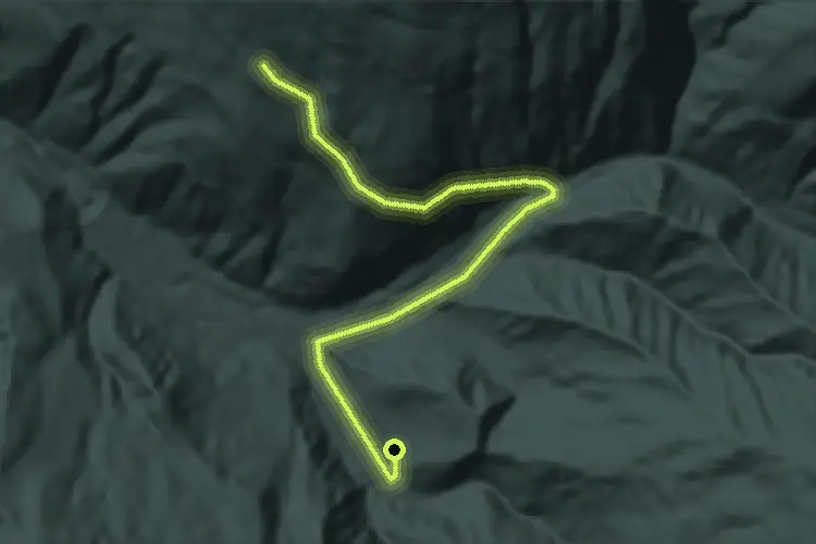
Easy · Trail
51B
2.7 km · ↑ 148 m · 58 min · 12 km away

Easy · Trail
52
4.8 km · ↑ 270 m · 1 h 42 min · 12 km away