Trails near Brilon
144 hikes starting within 15 km, nearest first.
Nearest first, page 1 of 3
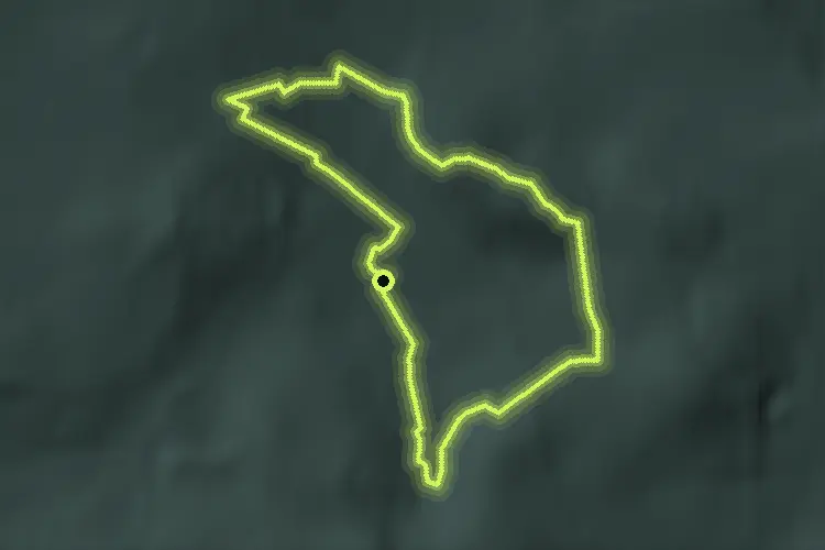
Easy · Summit
Brilon B2
4.2 km · ↑ 109 m · 1 h 16 min · 1 km away

Easy · Summit
Brilon B5
7.2 km · ↑ 199 m · 2 h 13 min · 2 km away

Easy · Trail
Geologischer Sprung
4.3 km · ↑ 169 m · 1 h 25 min · 2 km away
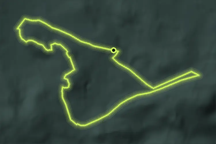
Medium · Summit
Brilon B3
8.7 km · ↑ 169 m · 2 h 32 min · 2 km away

Easy · Trail
Gudenhagen/Petersborn GP1
6.6 km · ↑ 183 m · 2 h · 3 km away

Medium · Summit
Soestweg Brilon-Kallenhardt
13.7 km · ↑ 235 m · 3 h 45 min · 3 km away

Easy · Summit
Brilon B4
7.8 km · ↑ 158 m · 2 h 18 min · 3 km away

Demanding · Summit
Gudenhagen/Petersborn GP2
23.2 km · ↑ 568 m · 7 h 2 min · 3 km away

Easy · Trail
Thülen Rundweg T2
3.1 km · ↑ 32 m · 50 min · 4 km away

Easy · Trail
[A4] Rundwanderweg "Zwöllberg - Eisenberg - Rinketal" bei Olsberg
7.0 km · ↑ 200 m · 2 h 12 min · 4 km away

Easy · Trail
Thülen Rundweg T1
2.1 km · ↑ 9 m · 34 min · 5 km away

Easy · Trail
Rothaarsteig-Zuweg Brilon-Wald
5.1 km · ↑ 165 m · 1 h 34 min · 5 km away

Easy · Trail
Schellhornkammweg
6.9 km · ↑ 223 m · 2 h 7 min · 5 km away

Easy · Trail
Hoppecke H2
4.1 km · ↑ 98 m · 1 h 13 min · 5 km away

Easy · Trail
Rundweg 3 Brilon-Wald
5.5 km · ↑ 197 m · 1 h 48 min · 5 km away

Easy · Trail
Hoppecke H3
5.1 km · ↑ 95 m · 1 h 27 min · 6 km away

Easy · Trail
Alme Rundweg Al1
3.1 km · ↑ 37 m · 50 min · 6 km away

Easy · Summit
Örenstein-Rundweg
6.1 km · ↑ 201 m · 1 h 58 min · 6 km away

Medium · Trail
Rundweg 4 Brilon-Wald
11.0 km · ↑ 312 m · 3 h 25 min · 7 km away

Medium · Summit
Hoher-Eimberg-Kammweg
13.5 km · ↑ 432 m · 4 h 8 min · 7 km away

Easy · Trail
[<] Verbindungsweg X1 zum X10
5.1 km · ↑ 145 m · 1 h 31 min · 7 km away

Easy · Trail
(4) Kurterrainweg 4
5.1 km · ↑ 145 m · 1 h 31 min · 7 km away

Easy · Trail
Rundweg 2 Brilon-Wald
6.3 km · ↑ 182 m · 1 h 58 min · 7 km away

Demanding · Summit
Rundweg 1 Brilon-Wald
7.5 km · ↑ 241 m · 2 h 24 min · 7 km away

Easy · Summit
Raute
5.0 km · ↑ 69 m · 1 h 20 min · 7 km away

Medium · Trail
Salzpfad Ringelstein - Brilon
10.1 km · ↑ 219 m · 2 h 51 min · 7 km away

Easy · Trail
Bontkirchen BK4
2.6 km · ↑ 62 m · 46 min · 7 km away

Easy · Trail
Rothaarsteig Zugang Olsberg
7.6 km · ↑ 298 m · 2 h 27 min · 7 km away

Easy · Summit
Langer Berg Rundweg A2
4.7 km · ↑ 134 m · 1 h 27 min · 7 km away

Easy · Summit
Sauerland-Waldroute (Südroute Marsberg - Warstein)
5.2 km · ↑ 105 m · 1 h 27 min · 7 km away

Easy · Summit
Nord Süd Trail, Abschnitt Eisenberg - Brilon
5.2 km · ↑ 105 m · 1 h 27 min · 7 km away

Easy · Trail
<3> Bezirksrundweg 3 bei Olsberg
3.9 km · ↑ 144 m · 1 h 13 min · 7 km away

Easy · Trail
Nehden Rundweg N1
4.4 km · ↑ 13 m · 1 h 9 min · 7 km away

Medium · Trail
Langenbergkammweg
10.2 km · ↑ 207 m · 2 h 52 min · 8 km away

Easy · Summit
Bontkirchen BK3
1.7 km · ↑ 61 m · 33 min · 8 km away

Easy · Summit
Messinghausen M5
1.6 km · ↑ 11 m · 25 min · 8 km away

Demanding · Summit
Bezirksrundweg Olsberg
28.6 km · ↑ 847 m · 8 h 58 min · 8 km away

Medium · Summit
Alme Rundweg Al3
8.3 km · ↑ 131 m · 2 h 22 min · 8 km away

Medium · Summit
Quellenweg Alme
5.3 km · ↑ 147 m · 1 h 38 min · 8 km away

Medium · Summit
Klippenweg
4.9 km · ↑ 318 m · 1 h 51 min · 8 km away

Easy · Summit
Brilon - Diemelsee
2.2 km · ↑ 62 m · 39 min · 8 km away

Easy · Trail
[◇2] Bezirksrundweg ◇2 bei Olsberg
7.8 km · ↑ 226 m · 2 h 19 min · 8 km away

Medium · Summit
Alme Rundweg Al2
8.1 km · ↑ 167 m · 2 h 24 min · 8 km away

Easy · Trail
Bontkirchen BK5
5.6 km · ↑ 94 m · 1 h 32 min · 8 km away

Easy · Summit
Erlebnispfad Bruchhauser Steine
2.3 km · ↑ 150 m · 54 min · 8 km away

Medium · Summit
Grenzstein-Weg
17.2 km · ↑ 316 m · 4 h 59 min · 9 km away

Easy · Trail
Heringshausen H4
5.9 km · ↑ 210 m · 1 h 53 min · 9 km away

Demanding · Trail
Rundwanderweg Büren-Harth – Harlebachweg
23.2 km · ↑ 500 m · 6 h 34 min · 9 km away