Trails near Merzig
72 hikes starting within 15 km, nearest first.
Nearest first, page 1 of 2

Medium · Trail
Rundwanderweg 20
10.9 km · ↑ 129 m · 3 h 1 min · 1 km away

Medium · Trail
Rundwanderweg 12
11.8 km · ↑ 166 m · 3 h 19 min · 2 km away

Easy · Trail
Rundwanderweg 5
7.7 km · ↑ 264 m · 2 h 30 min · 3 km away

Easy · Trail
Rundwanderweg 1
3.2 km · ↑ 129 m · 1 h 4 min · 3 km away

Medium · Trail
Rundwanderweg 8
11.0 km · ↑ 207 m · 3 h 12 min · 3 km away

Medium · Trail
Sonnensteinwanderweg
12.7 km · ↑ 227 m · 3 h 40 min · 3 km away

Medium · Trail
Rundwanderweg 13
9.5 km · ↑ 215 m · 2 h 51 min · 3 km away

Medium · Trail
Wolfsweg
10.2 km · ↑ 295 m · 3 h 12 min · 3 km away

Easy · Trail
Rundwanderweg 14
6.0 km · ↑ 135 m · 1 h 47 min · 4 km away

Easy · Trail
Rundwanderweg 17
6.8 km · ↑ 41 m · 1 h 48 min · 4 km away

Easy · Trail
Rundwanderweg 4
6.4 km · ↑ 163 m · 1 h 57 min · 4 km away

Easy · Trail
Rundwanderweg 18
5.4 km · ↑ 110 m · 1 h 35 min · 4 km away

Medium · Trail
Rundwanderweg 11
13.9 km · ↑ 404 m · 4 h 9 min · 5 km away

Medium · Trail
Rundwanderweg 3
14.8 km · ↑ 354 m · 4 h 15 min · 5 km away

Easy · Trail
Wilder Wald Weg
2.9 km · ↑ 43 m · 48 min · 5 km away

Demanding · Trail
Rundwanderweg M
30.7 km · ↑ 563 m · 8 h 58 min · 6 km away

Demanding · Trail
Clemens Holzmeister Weg
23.8 km · ↑ 471 m · 6 h 39 min · 6 km away

Medium · Trail
Traumschleife: Bietzerberger
9.6 km · ↑ 198 m · 2 h 50 min · 6 km away

Demanding · Trail
Rundwanderweg 2
18.6 km · ↑ 455 m · 5 h 23 min · 6 km away

Easy · Trail
Mathias Enzweiler Weg
4.7 km · ↑ 150 m · 1 h 25 min · 7 km away

Easy · Trail
Rundwanderweg 15
6.3 km · ↑ 151 m · 1 h 55 min · 7 km away

Medium · Trail
Traumschleife: Beckinger SaarBlicke
14.2 km · ↑ 336 m · 4 h 17 min · 7 km away

Demanding · Summit
Oppig-Grät-Weg (Winterverlauf)
11.2 km · ↑ 353 m · 3 h 34 min · 7 km away

Demanding · Summit
Oppig-Grät-Weg (Sommerverlauf)
12.4 km · ↑ 410 m · 3 h 59 min · 8 km away

Medium · Trail
Promenade Circulaire de Waldwisse
11.7 km · ↑ 210 m · 3 h 23 min · 8 km away

Easy · Trail
Verbindungsweg zum Europäischen Fernwanderweg E3
6.9 km · ↑ 220 m · 2 h 6 min · 9 km away

Medium · Summit
Steinhauerweg
10.0 km · ↑ 208 m · 2 h 57 min · 9 km away

Medium · Trail
Saarhölzbachpfad
12.9 km · ↑ 388 m · 4 h 3 min · 9 km away

Medium · Trail
Schluchtenpfad
10.8 km · ↑ 403 m · 3 h 34 min · 9 km away

Medium · Summit
Waldsaumweg
10.0 km · ↑ 275 m · 3 h 6 min · 9 km away

Expert · Summit
Litermont-Sagenweg
18.6 km · ↑ 459 m · 5 h 38 min · 9 km away

Medium · Trail
Saarschleife-Tafeltour
15.5 km · ↑ 587 m · 5 h 9 min · 10 km away

Easy · Trail
Cloefpfad
7.6 km · ↑ 309 m · 2 h 34 min · 10 km away

Demanding · Summit
Wehinger Viezpfad
13.9 km · ↑ 470 m · 4 h 29 min · 10 km away

Demanding · Summit
Saarwanderweg / Sentier de la Sarre
47.7 km · ↑ 1406 m · 14 h 18 min · 10 km away

Medium · Trail
Maria-Croon-Weg
14.6 km · ↑ 246 m · 3 h 59 min · 10 km away

Easy · Trail
Kaiserweg
4.8 km · ↑ 89 m · 1 h 27 min · 11 km away

Easy · Trail
Höckerlinienpfad
3.1 km · ↑ 50 m · 53 min · 11 km away

Medium · Trail
Der Bergener
11.1 km · ↑ 244 m · 3 h 18 min · 11 km away

Medium · Trail
Der Hochwälder
9.2 km · ↑ 178 m · 2 h 41 min · 11 km away

Easy · Trail
Stauseerundweg
7.1 km · ↑ 102 m · 1 h 54 min · 11 km away
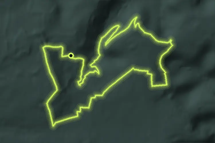
Medium · Summit
Der Gisinger
10.8 km · ↑ 267 m · 3 h 16 min · 11 km away

Easy · Summit
Hirn-Gallenberg-Tour
7.4 km · ↑ 162 m · 2 h 12 min · 12 km away

Easy · Trail
Sonnenrunde
4.8 km · ↑ 65 m · 1 h 21 min · 12 km away

Medium · Summit
Idesbachpfad
16.9 km · ↑ 626 m · 5 h 35 min · 12 km away

Medium · Trail
Druidenpfad
8.8 km · ↑ 164 m · 2 h 26 min · 12 km away

Medium · Trail
Nordic Walking, Strecke 3 schwer
8.7 km · ↑ 148 m · 2 h 30 min · 12 km away

Medium · Trail
Stausee Tafeltour
9.9 km · ↑ 243 m · 3 h 1 min · 12 km away